Location map of the 7 study-sites in the EnviEFH project. Besides fishing activities, the sites sustain important bottom substrates and associated biological community assemblages offering important spawning and nursery habitat for a variety of species. The whole Mediterranean Sea is considered for mapping offshore Essential Fish Habitats.


The consortium works on 7 coastal marine regions as pilot-study areas for coastal EFH mapping (e.g. for coastal spawning species) while the whole Mediterranean Sea is mapped for offshore EFH (e.g. offshore spawning species and alternative fishing grounds). The selection of the 7 pilot study-areas is based on the fact that these areas support a high fisheries production of commercially important species, they are influenced by certain productive ocean processes and are characterised by important sediment and associated biological assemblages functioning as nursery/spawning/recruitment grounds for many species.

  • 1. North Aegean Continental Shelf (GR): Located in North Aegean Sea, this area supports nearly 60% of commercial fisheries production in Greece and a variety of spawning/nursery and feeding habitats while it is environmentally influenced by river run-off, Black Sea water intrusion and strong wind patterns resulting in a variety of transient ocean processes, such as fronts and eddies.

  • 2. Cyclades Plateau (GR): Located in Central Aegean Sea, this area supports important fishing grounds, which are used by a great number of fishing communities based on numerous small islands of the Aegean archipelagos. The area also supports a variety of benthic community assemblages that create favouring spawning habitats for many species.

  • 3. Cretan Continental Shelf (GR): Located north of Crete Island, this area supports important benthic substrates and associated communities as well as fishing and spawning grounds while it is influenced by numerous productive ocean processes that greatly affect the general oligotrophic state of the region.

  • 4. Ionian Sea (GR): Located west of the Greek Peninsula, this area supports important fishing and spawning/nursery grounds and is characterised by extreme changes in bottom topography that create important spawning and feeding habitats. The area is influenced by numerous ocean processes (e.g. eddies and fronts) that enhance the productivity levels of the region.

  • 5. Eastern French Mediterranean Coast (FR): Located in the Bouches-du-Rhone and the Var sections of the French Mediterranean coast, this site belongs to the NATURA 2000 program. The site accounts for different habitats from rocky substratum to sandy areas with Posidonia beds. The fishing activity is mainly targeted by artisanal fishermen, with numerous targets according to the season and the substratum.

  • 6. Western French Mediterranean Coast (FR): Located in the far western section of the French Mediterranean coast, the site accounts for a total rocky shore ecosystem that belongs to the NATURA 2000 program. The site is mostly characterized by rocky habitats together with numerous Posidonia seagrass beds. The fishing activity is accommodated with a marine protected area that occupies part of the site.

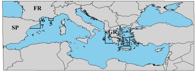
  • 7. Catalan Coast (SP): The Catalan coast lies on the north-western region of the Western Mediterranean Sea, to the south of the Gulf of Lions. The shelf is quite narrow except in the southern part of the area, in front of the Ebro River Delta. The northern area is characterised by the presence of submarine canyons approaching to within few miles of the coast. The region is affected by a permanent density front separating the less saline shelf waters from the more saline open sea waters. In association to this front, the Liguro-Provencal current flows in a SW direction along the continental slope. The shelf is subject to high spatial and temporal variability due to inputs of continental runoff, mainly from the Rhone River in the northern Gulf of Lions and the Ebro River. The area supports pelagic and demersal fisheries.


    Some of the GIS-processed environmental data (satellite imagery) and bathymetry grid for the study sites above include:
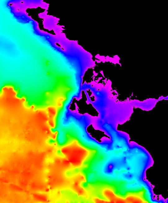
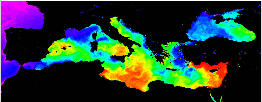
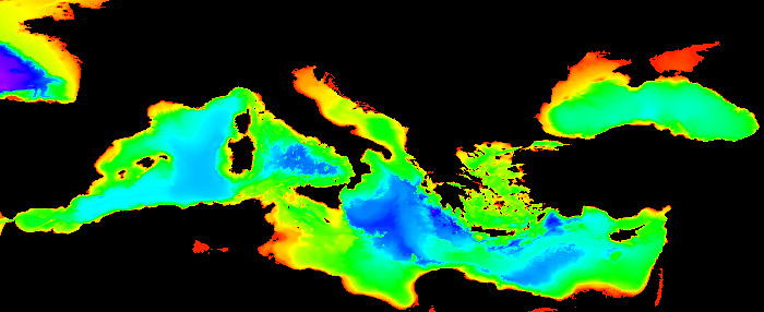
    Sea surface temperature (SST) Source: DLR-EOWEB, Germany
    Temperature/Salinity climatologies in various depths (TC/SC) Source: NOAA-NESDIS-NODC, USA
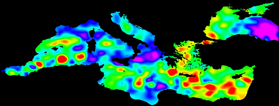
    Sea Surface Chlorophyll-a (Chl-a) Source: NASA-OceanColorWEB, USA
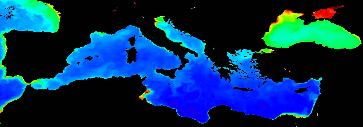
    Sea surface salinity (SAL) Source: IRI-LDEO-CDL, USA
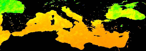
    Photosynthetically active radiation (PAR) Source: NASA OceanColor WEB, USA
    Sea Surface Altimetry (ALT) Source: CNES-CLS-Aviso, France
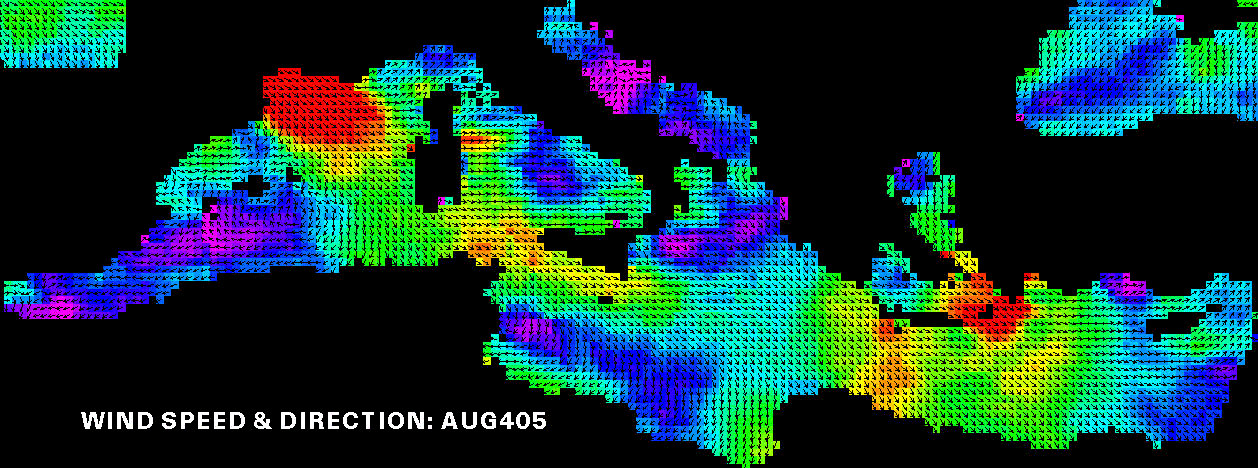
    Wind Speed and Direction Source: RS Systems, USA
    Mediterranean Bathymetry Source: General Bathymetric Chart of the Oceans (GEBCO)

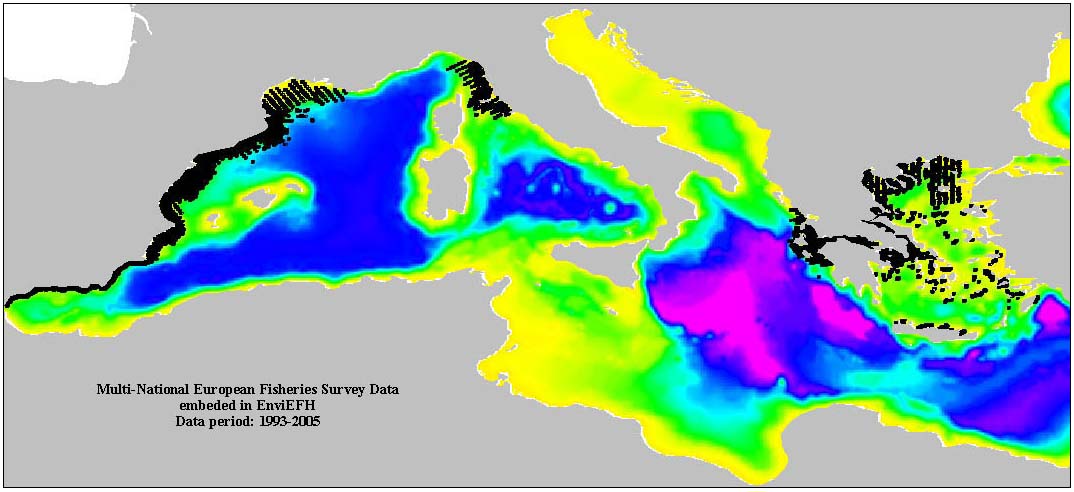
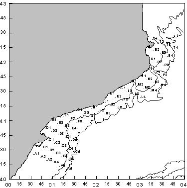
    Example of fisheries surveyed data in Greece, Spain and France embeded as initial input in EFH mapping: