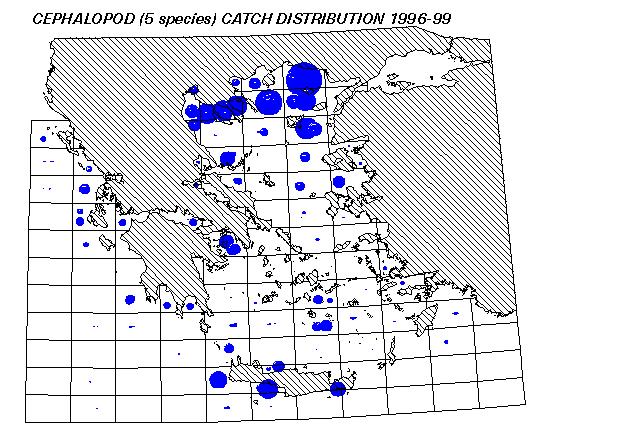
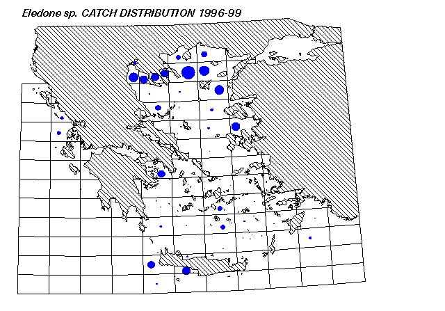
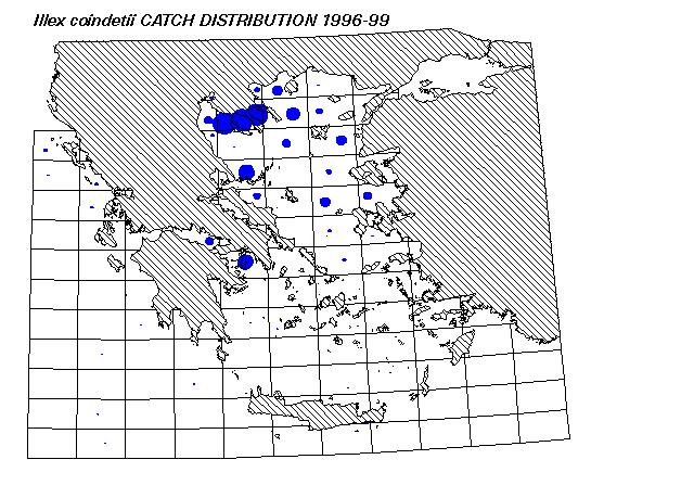
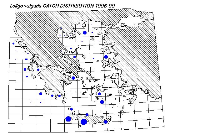
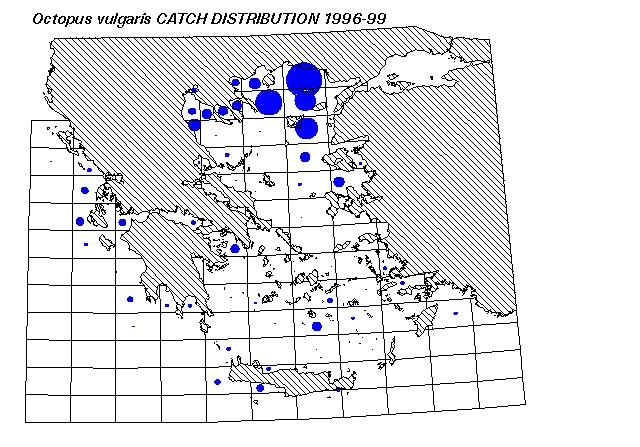
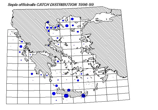
These GIS maps were produced by plotting 1996-99 species catch data,
derived by 25 sampling stations around Greece.