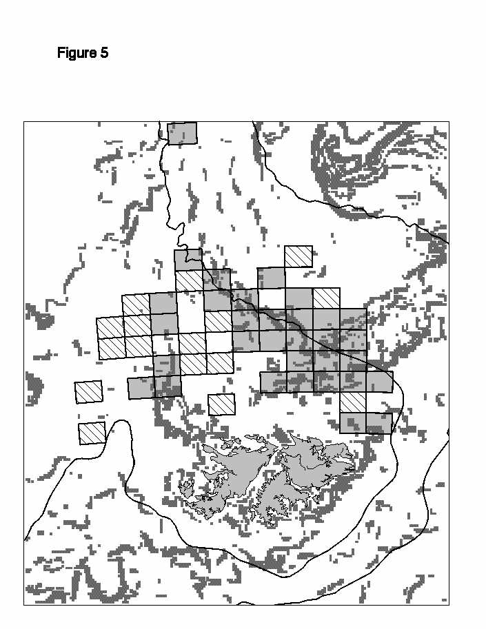
Location of fishing effort for satellite image from 1 March 1995. Boxed cells represent areas in which fishing took place during the calendar week
in which the image was taken. Cells coloured grey fall within gradient regions and diagonally striped cells fall outside gradient regions. (-) 200 and 1000m contours.