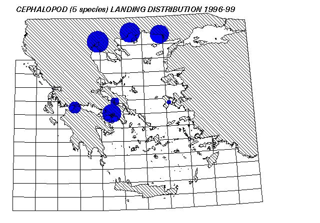
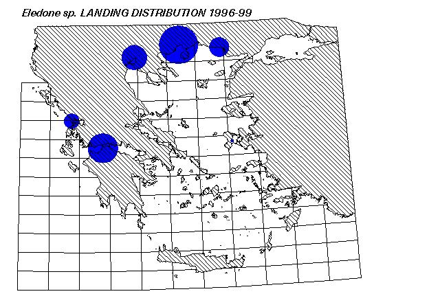
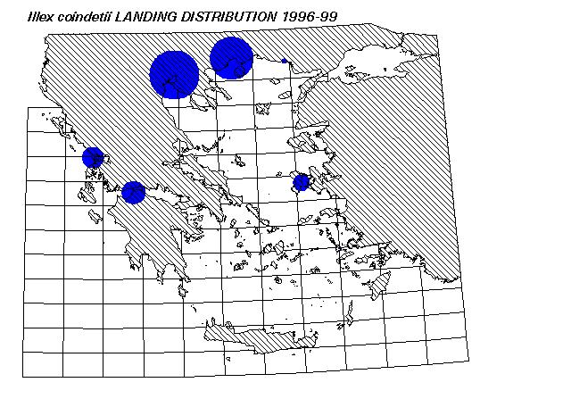
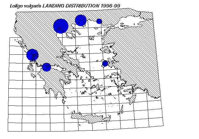
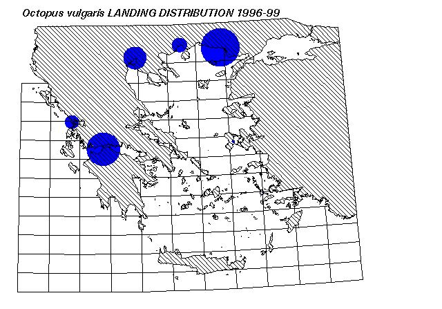
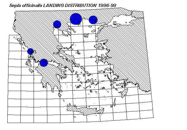
These GIS maps were produced by plotting 1996-99 species landing data,
derived by ETANAL, a private statistical survey company.