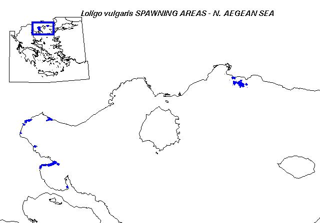
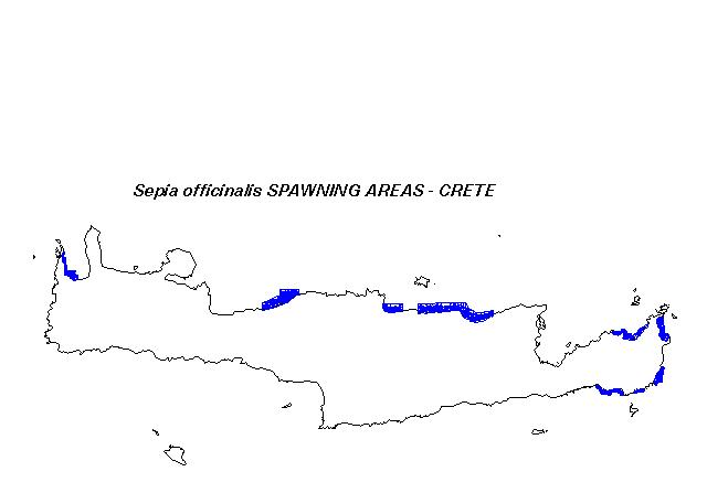
These GIS maps were produced by integrating species life-history data on spawning substrate and temperature preferences,
bathymetry, aerial orthophotos of bottom sediments, AVHRR SST imagery, and RoxAnn sediment hydroacoustic survey data.