
*** Please note that these tools are not distributed ***
It would be easier to contact us for further information.
| (MT-#01) *FishGIS* |
A tool for 3D marine data interfacing. This tool creates a GIS database from CTD, acoustic, and trawl data and integrates these data via interfaced routines in 3D space.
(MT-#02) *CMIS* |
A tool for Cephalopod resource studies. | This tool creates a GIS database from satellite (AVHRR, SeaWiFS) and production data and examines the relations of Cephalopod resources with their environment based on species life-history data.
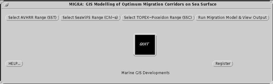
(MT-#03) *MIGRA* |
A tool for species migration studies. | This tool integrates various satellite data (AVHRR, SeaWiFS, TOPEX-Poseidon) and outputs migration paths and corridors based on species life-history data.
(MT-#04) *UPWELL* |
A tool for upwelling studies. | This tool integrates various satellite data (AVHRR, TOPEX-Poseidon), identifies upwelling spots in AVHRR images according to the upwelling theory, and creates upwelling indices by applying certain image measurement routines.
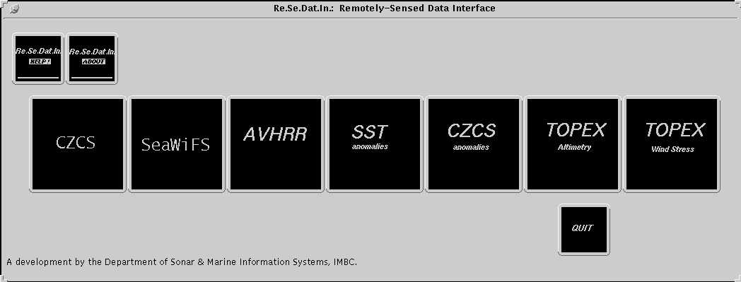
(MT-#05) *Re.Se.Dat.In* |
A tool for satellite database update. | This tool downloads various satellite images from worldwide public servers (DLR, NASA, US MIL) and process the images in a GIS-ready format.
(MT-#06) *TempChlor* |
A tool for studing sea surface water. | This tool uses satellite data and applies certain characteristics to sea surface water according to its temperature and chl-a content.
(MT-#07) *T/C_Pred* |
A tool for sea surface predictions. | This tool uses time-series satellite images (AVHRR and SeaWiFS) and outputs short-term (weekly and monthly) predictions of SST and Chl-a.
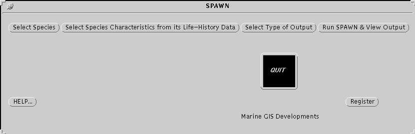
(MT-#08) *SPAWN* |
A tool for species spawning areas studies. | This tool integrates various satellite images with surveyed data and species life-history data to identify species spawning locations.
(MT-#09) *AGGREGATE* |
A tool for species concentration studies. | This tool integrates various satellite images and predictions with time-series data of species production and outputs species concentration areas.
(MT-#10) *GISWEB* |
A tool for GIS dissemination over the web. | This tool prepares GIS output (thematic & synthetic maps, reports, time-series integrated graphs) in a set of animated cartography products for display and dissemination on the internet.
(MT-#11) *CoastZone* |
A tool for integrated coastal zone management. | This tool integrates various satellite images, calculated data, human population data and certain coastal characteristics to output different management scenarios based on resource sustainable development.
| |